06 June 2014
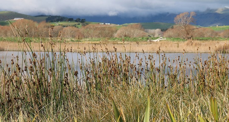
Ahuriri, or Ahuriri Lagoon, is a significant mahinga kai resource located on the Huritini/Halswell River between Tai Tapu and Motukarara. This lagoon was an important influence in the location of the Ngāti Koraha pā/village complex located on the Te Mokopeke/spurs directly above the lagoon and extending toward Motukarara.
Pre-drainage, this area was a large lagoon/wetland area surrounded by “koraha” or mudflats created by the pre-European lake levels of Te Waihora. Between 3-4 metres above sea level, Ahuriri would, at times, become fully integrated with the larger waterbody of Te Waihora. In particular, this wetland area supported a large harakeke/flax wetland that gave rise to a large flax mill that operated during the mid to late 19th century.
Because of the productivity of this lagoon, the area was extensively occupied by the Ngāti Koraha people. Pā me ngā kāinga nohoanga/fortifications and living sites are located on the spurs directly above the lagoon and extend toward Motukarara. A small warm (geothermal) waipuna/spring is also a valued and unique resource for this area.
A western-most tip of the Te Mokopeke/spur that runs down from Gebbies Pass, juts out into the side of the Ahuriri Lagoon. This site has important occupation and spiritual associations for Ngāi Tahu. There is also some small remnant of dryland vegetation on this site that enhances its special link to past occupation.
The drainage of Ahuriri
As a result of mid-19th century claims by Ngāi Tahu to the Government regarding inadequate mahinga kai areas, Judge Fenton set aside a number of fishing easements for the various hapū in Canterbury. One such reserve, Te Koraha, was set aside adjacent to Ahuriri. The owners of this reserve are the hapū from Ngāi Tūāhuriri in the north to Ngāi Te Ruahikihiki in the south and includes the hapū of Te Pātaka a Rākaihautū/Banks Peninsula.
Unfortunately, due to the drainage of Te Waihora/Lake Ellesmere and construction of drainage channels throughout the Halswell catchment, Ahuriri was completely drained and the fishing easement rendered useless. The bed of the historic lagoon is now predominately pasture (with some remnant wetland sites) and is administered by Environment Canterbury. SH 75, the main road from Christchurch to Akaroa, passes through the area.
Ahuriri Reserves (also known as Ahuriri Lagoon) comprises 250ha. The area was first gazetted as a sanctuary for game birds in 1897. It provides protected breeding habitats for birds and fish, and a sanctuary for birds during hunting season.
The restoration of Ahuriri
Despite extensive drainage and pastoral development, Ahuriri Reserves are still by far the most significant wetland habitat in the Greenpark-Tai Tapu-Halswell-Christchurch Lowlands (outside of Te Waihora itself). Winter ponding provides extensive shallow margins, which attract thousands of wetland birds, both waders and waterfowl. These include kōau/black cormorant, kakī ānau/black swan, Canada geese, pūtakitaki/paradise shelduck, rakiraki/mallard/grey duck, tētē/grey teal, tataa/New Zealand shoveller.
Environment Canterbury land at Ahuriri is managed to Best Management Practice Standard and includes riparian planting and the managing of grazing and license conditions.
Community have been at the heart of recent restoration planning and actions at Ahuriri Lagoon. The Ahuriri Lagoon Steering Group (made up of representatives of rūnanga and neighbouring farmers) have worked together to create a visionary restoration plan for the restoration of the Ahuriri Lagoon area in Environment Canterbury ownership. This plan, and the input of the Ahuriri Lagoon Steering Group, were the basis for the creation of the Whakaora Te Ahuriri project that has developed a constructed wetland.

